Show me from space-satellite imagery for location insights
AI-powered satellite imagery tool
Show me London
Show me the Alps in winter
Teach me about river deltas with images of real examples
Show me an random interesting event which can be seen in satellite images (not a volcano)
Related Tools
Load More
Geography Geo
🔷#𝟏 𝐏𝐞𝐫𝐬𝐨𝐧𝐚𝐥𝐢𝐳𝐞𝐝 𝐆𝐞𝐨𝐠𝐫𝐚𝐩𝐡𝐲 𝐓𝐮𝐭𝐨𝐫🔷
EarthGPT - Maps, Satellite Images, Geography
Explore planet earth using maps and satellite images right within ChatGPT.

Geo+
Your assistant for quick geospatial analysis
Astronomy Scholar
Astronomy Expert
What is this place?
I can quickly provide insights and facts about any location worldwide by image or photo
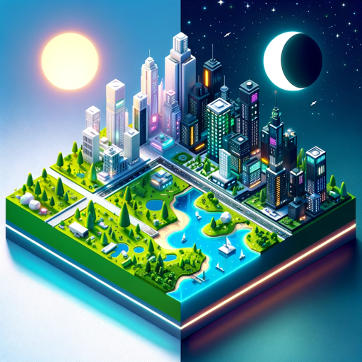
Weather Artist
Day-night split 3D weather illustrations
20.0 / 5 (200 votes)
Overview of 'Show me from space'
'Show me from space' is a specialized tool designed to provide users with access to satellite imagery, specifically focusing on data from the Copernicus program's Sentinel satellites. The tool allows users to visualize real-time or recent imagery of specific locations on Earth. It leverages satellite data, primarily from the Sentinel-2 and Sentinel-3 missions, to offer high-resolution imagery that can be used for various applications such as environmental monitoring, disaster response, urban planning, and more. The core functionality revolves around enabling users to view specific geographic areas through satellite images within a specified time range, highlighting events or changes over time. For example, a user might request to see the aftermath of a natural disaster like a wildfire or a flood, and 'Show me from space' will provide a link to the most relevant and clear satellite imagery that captures the event's impact. Another example could be a researcher studying deforestation who might use the tool to observe changes in forest cover over several months or years.

Primary Functions of 'Show me from space'
Real-time and Recent Satellite Imagery Access
 Example
A user wants to see a recent satellite image of New York City to observe any visible changes in the urban landscape.
ScenarioThe tool provides a link to the most recent cloud-free satellite image of New York City, allowing the user to explore the city's layout, infrastructure, and any noticeable changes in the area. This function is particularly useful for urban planners, researchers, or individuals interested in monitoring environmental or infrastructural developments.
Event-specific Imagery
ExampleA user requests imagery of a specific location before and after a hurricane to analyze the extent of the damage.
ScenarioThe tool delivers two links: one showing satellite imagery of the area just before the hurricane struck and another from shortly after the event. This allows the user to compare the images and assess the impact of the hurricane, which is valuable for disaster response teams, insurance companies, and environmental researchers.
Historical Image Comparison
ExampleA user is studying glacial retreat and requests images of a glacier from 2018 and 2023.
ScenarioThe tool provides satellite imagery from the specified years, enabling the user to visually compare the glacier's size and analyze its retreat over time. This function is crucial for climate scientists, geographers, and educators who are tracking environmental changes.
Target User Groups for 'Show me from space'
Environmental Researchers and Scientists
This group benefits from the ability to access and compare satellite imagery over time to study changes in the environment, such as deforestation, glacial retreat, or urban sprawl. The tool's capacity to deliver specific temporal snapshots of geographic areas makes it ideal for long-term environmental monitoring and research.
Disaster Response and Management Teams
These users require immediate access to satellite imagery to assess the impact of natural disasters such as floods, wildfires, or hurricanes. By providing up-to-date and clear imagery of affected areas, the tool helps in planning response efforts, allocating resources, and evaluating the extent of damage. The ability to compare before and after images is particularly valuable for these teams.
How to Use Show me from space
1
Visit aichatonline.org for a free trial without login, also no need for ChatGPT Plus.
2
Enter your request with a specific location or event you want to view using satellite imagery.
3
Receive a link generated by the tool that directs you to a detailed satellite image of the specified area or event.
4
Click the link to view the imagery, which is centered on the location and tailored to your query's specifics.
5
Explore different zoom levels and time ranges within the Copernicus Browser to analyze the imagery further.
Try other advanced and practical GPTs
.AI Lawyer
AI-Powered Legal Assistance at Your Fingertips

Prompt Evaluator
AI-powered tool for perfecting prompts

DM Guru
AI-Powered Assistant for D&D Masters

Task Helper
Effortless AI-powered task management

Course Creator GPT
AI-powered tool for creating structured, customized courses.

Replicated 😁
AI-powered image replication tool

ブログ記事の見出し作成特化GPTくん
AI-powered blog titles and headings for SEO success

Brainwave Analyst
AI-Powered EEG Analysis and Insights

SEO Title And Description Optimizer
Optimize Your Titles and Descriptions with AI

Course Creator Assistant
AI-powered tool for creating engaging online courses

Market Research Reports
AI-Powered Insights for Strategic Growth

Yana, asistenta virtuală a firmei Velcont
AI-powered solutions for Romanian businesses.

- Urban Planning
- Event Analysis
- Environmental Monitoring
- Research Visualization
- Disaster Response
Frequently Asked Questions About Show me from space
What kind of satellite imagery can I view using Show me from space?
You can view high-resolution satellite images, primarily from the Sentinel-2 and Sentinel-3 satellites. The tool can show natural color images, false color images, and SAR data for specific locations and events.
Can I view historical satellite imagery?
Yes, you can view historical imagery, particularly from the Sentinel satellites, which have data going back to around 2016. You can select different time ranges to see how an area has changed over time.
Is it possible to see changes before and after an event?
Yes, you can request satellite images from before and after specific events like natural disasters or urban development. The tool will generate links to view these changes using the most relevant and clear images available.
How detailed are the images provided by Show me from space?
The detail depends on the zoom level and the specific satellite data used. Sentinel-2, for instance, provides imagery at resolutions that can show details down to 10 meters per pixel, suitable for viewing city-level or regional changes.
Can I use Show me from space for monitoring environmental changes?
Absolutely. The tool is perfect for monitoring deforestation, glacial retreat, urban expansion, and other environmental changes by providing up-to-date and historical satellite imagery.